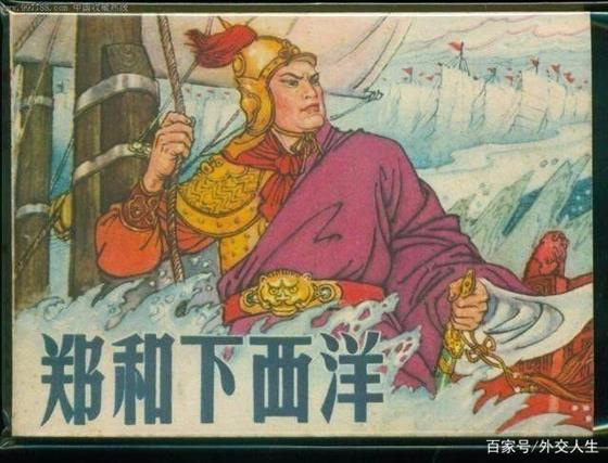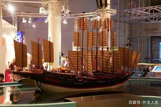
郑和下西洋是明代永乐、宣德年间的一场海上远航活动,首次航行始于永乐三年(1405年),末次航行结束于宣德八年(1433年),共计七次。
由于使团正使由郑和担任,且船队航行至婆罗洲以西洋面(即明代所谓“西洋”),故名。
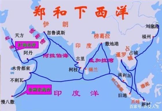
在七次航行中,三宝太监郑和率领船队从南京出发,在江苏太仓的刘家港集结,至福建福州长乐太平港驻泊伺风开洋,远航西太平洋和印度洋,拜访了30多个国家和地区,其中包括爪哇、苏门答腊、苏禄、彭亨、真腊、古里、暹罗、榜葛剌、阿丹、天方、左法尔、忽鲁谟斯、木骨都束等地,已知最远到达东非、红海。
郑和下西洋是中国古代规模最大、船只和海员最多、时间最久的海上航行,也是15世纪末欧洲的地理大发现的航行以前世界历史上规模最大的一系列海上探险。
然而,关于郑和船队的航海目的、航行范围等史实以及对七次航行的评价,仍存在争议。
Zheng He's voyage to the West was a sea voyage during the Yongle and Xuande years of the Ming Dynasty. The first voyage began in the third year of Yongle (1405), and the last voyage ended in the eighth year of Xuande (1433), a total of seven times.
Because the mission is being entrusted by Zheng He, and the fleet sails to the west of Borneo (the so-called "Western" in the Ming Dynasty), hence the name.
During the seven voyages, the Sanbao eunuch Zheng He led a fleet from Nanjing and assembled in Liujiagang, Taicang, Jiangsu, and berthed at Taiping Port in Changle, Fuzhou, Fujian, sailing to the Western Pacific and Indian Ocean, visiting more than 30 countries and regions, including Java, Sumatra, Sulu, Pahang, Chenla, Guri, Siam, Bangkar, Adam, Tianfang, Zufaer, Krumos, Mugudushu and other places, the most known Far reaching East Africa and the Red Sea.
Zheng He's voyages to the West were the largest maritime voyage in ancient China, with the largest number of ships and seafarers, and the longest time. It was also the largest series of maritime expeditions in the history of the world before the voyage of European geological discoveries at the end of the 15th century.
However, there are still controversies regarding the historical facts of Zheng He's fleet, such as the purpose and scope of navigation, and the evaluation of the seven voyages.
明代初期,由于朱元璋三十一年的励精图治,农业经济恢复了。
在手工业方面,也有了很大的发展:矿冶、纺织、陶瓷、造纸、印刷各方面,都比以前有了不同程度的提高。
此外,元末时江南地区已有相当规模的海船建造业,到明初更建立起了规模庞大的官营造船业,除南京龙江宝船厂外,在苏州、松江、镇江等地均设有官厂。
明初工商业的恢复和发展,宋、元以来中国海外贸易的发达,对外移民的增加,所有这一切,都为郑和下“西洋”准备了坚实的经济基础和物质条件。
在经济获得良好的发展之后,发展海外交通和海外的贸易已经是十分迫切的事。中国的丝织品、瓷器受到西洋诸国的欢迎,赢得了很高的声誉。而中国对不能自行生产的香料等物,也有较大的需求。
At the beginning of the Ming Dynasty, due to Zhu Yuanzhang's 31 years of hard work, the agricultural economy recovered.
In the handicraft industry, there have also been great developments: mining and metallurgy, textiles, ceramics, papermaking, and printing have all improved to varying degrees than before.
In addition, at the end of the Yuan Dynasty, there was already a considerable sea-going shipbuilding industry in the Jiangnan area. By the beginning of the Ming Dynasty, a large-scale official shipbuilding industry had been established. In addition to Nanjing Longjiang Bao Shipyard, it was established in Suzhou, Songjiang and Zhenjiang. There are official factories.
The restoration and development of industry and commerce in the early Ming Dynasty, the development of China's overseas trade since the Song and Yuan Dynasties, and the increase in foreign immigration, all of these have prepared a solid economic foundation and material conditions for Zheng He's "Voyage to the West”.
After the economy has developed well, the development of overseas transportation and overseas trade has become a very urgent matter. Chinese silk fabrics and porcelain have been welcomed by Western countries and have won a high reputation. China also has a greater demand for spices and other substances that cannot be produced on its own.

根据《郑和航海图》,郑和使用海道针经(24/48方位指南针导航)结合过洋牵星术(天文导航),在当时是最先进的航海导航技术。郑和的船队,白天用指南针导航,夜间则用观看星斗和水罗盘定向的方法保持航向。由于对船上储存淡水、船的稳定性、抗沉性等问题都作了合理解决,故郑和的船队能够在“洪涛接天,巨浪如山”的险恶条件下,“云帆高张,昼夜星驰”,很少发生意外事故。白天以约定方式悬挂和挥舞各色旗带,组成相应旗语。夜晚以灯笼反映航行时情况,遇到能见度差的雾天下雨,配有铜锣、喇叭和螺号也用于通讯联系。
在天文航海技术方面,中国很早就可以通过观测日月星辰测定方位和船舶航行的位置。郑和船队已经把航海天文定位与导航罗盘的应用结合起来,提高了测定船位和航向的精确度,人们称“牵星术”。用“牵星板”观测定位的方法,通过测定天的高度,来判断船舶位置、方向、确定航线.,这项技术代表了那个时代天文导航的世界先进水平。
在地文航海技方面,郑和下西洋的地文航海技术,是以海洋科学知识和航海图为依据,运用了航海罗盘、计程仪、测深仪等航海仪器,按照海图、针路簿记载来保证船舶的航行路线。航行时确定航行的线路,叫作针路。罗盘的误差,不超过2.5度。
关于航海图,英国李约瑟在《中国科技史》一书中指出:关于中国航海图的精确性问题,米尔斯(Mills)和布莱格登(Blagdon)曾作了仔细的研究,他们二人都很熟悉整个马来半岛的海岸线,而他们对中国航海图的精确性作出了很高的评价。
According to the "Zheng He Navigation Chart", Zheng He used the Haidao Needle Channel (24/48 azimuth compass navigation) combined with the trans-ocean astronomy (celestial navigation), which was the most advanced navigation navigation technology at the time. Zheng He's fleet uses a compass to navigate during the day, and at night to keep its course by watching the star and water compass. Due to the reasonable solution to the problems of fresh water storage on the ship, the stability of the ship, the resistance to sinking, etc., Zheng He’s fleet was able to sail under the dangerous conditions “waves connecting the sky and waves over waves like mountains”. "Day and night ", accidents rarely occur. In the daytime, various colored flags are hung and waved in an agreed manner to form the corresponding semaphore. At night, lanterns are used to reflect the sailing situation. When it rains in foggy days with poor visibility, it is equipped with gongs, horns and snails for communication.
In terms of astronomical navigation technology, China has long been able to determine the azimuth and the position of ships sailing by observing the sun, moon and stars. The Zheng He fleet has combined the application of navigational astronomical positioning with the navigation compass to improve the accuracy of determining ship position and heading. People call it "stretching". Using the "starboard" method of observing and positioning, by measuring the altitude of the sky, the ship's position, direction, and route are determined. This technology represents the world's advanced level of celestial navigation in that era.
In terms of geography and navigation technology, Zheng He’s geography and navigation technology for voyages to the West is based on marine scientific knowledge and nautical charts, using navigational instruments such as compasses, logs, and depth sounders. Book records to ensure the navigation route of the ship. The route of sailing is determined when sailing, which is called needle route. The error of the compass shall not exceed 2.5 degrees.
Regarding nautical charts, Needham of the United Kingdom pointed out in the book "History of Science and Technology in China": Mills and Blagdon have done careful research on the accuracy of Chinese nautical charts, and both of them are familiar The entire coastline of the Malay Peninsula, and they have made a high evaluation of the accuracy of China's nautical charts.
明初的外交有意沿袭元代的规模, 但在邦交理念上有所不同。明太祖积极、主动发展与藩国的邦交关系,对周边国家采“不侵占”的态度,并在《皇明祖训》中开列了十五个“不征之国”,试图构建一个以中国为主导,有等级秩序的、和谐的理想世界秩序。有观点认为,明廷以此为基础形成了和平外交模式,影响有明近三百年。也有观点认为,“不征”是明朝对内设定的最优外交目标,并不意味着完全排斥武力;明朝的目的在于以武力为后盾,力争以不动兵戈的方式实现威服众邦,构建以明帝国为中心的国际秩序格局;而具体交往模式的选取,又与交往对象在明朝外交层级中的位置有关。
靖难之役中夺得皇位的朱棣,锐意沟通域外国家。在郑和之前,他派遣尹庆于永乐元年(1403年)出使了古里、满剌加(当时尚未建国),又于永乐二年(1404年)出使了爪哇和苏门答腊。 在郑和下西洋初期,明成祖又南征安南,将之纳入明王朝版图。“郡县安南”之后,明朝从陆路近可制占城,远可控满剌加,为郑和后续的下西洋活动提供了有力的支持,使西洋朝贡体系得以顺利建立和巩固。

The diplomacy of the early Ming Dynasty deliberately followed the scale of the Yuan Dynasty, but differed in the concept of diplomatic relations. Ming Taizu actively developed diplomatic relations with the vassal states, adopted a "non-occupied" attitude towards neighboring countries, and listed fifteen "countries not to be conquered" in the "Huang Ming Zu Xun" in an attempt to build a country based on China. Leading, hierarchical and harmonious ideal world order. Some believe that Ming Ting formed a model of peaceful diplomacy based on this, which has influenced Ariake for nearly 300 years. There is also a view that "non-commissioning" is the optimal diplomatic goal set by the Ming Dynasty internally, and it does not mean that force is completely rejected; the purpose of the Ming Dynasty is to use force as a backing, and strive to achieve conviction by not using military force. State, the establishment of an international order structure centered on the Ming empire; and the selection of the specific communication mode is related to the position of the contacts in the diplomatic hierarchy of the Ming Dynasty.
Zhu Di, who won the throne in the battle of Jingnan, determined to communicate with foreign countries. Before Zheng He, he dispatched Yin Qing to Guli and Manlaga in the first year of Yongle (1403), and to Java and Sumatra in the second year of Yongle (1404). In the early period of Zheng He's voyages, Ming Chengzu also conquered Annan to the south and included it in the Ming Dynasty. After the "County Annan", the Ming Dynasty could control Champa from the land, and control it from afar. This provided strong support for Zheng He's subsequent voyages to the West and enabled the Western tributary system to be successfully established and consolidated.
